01 // Automated data
Instant Site Context
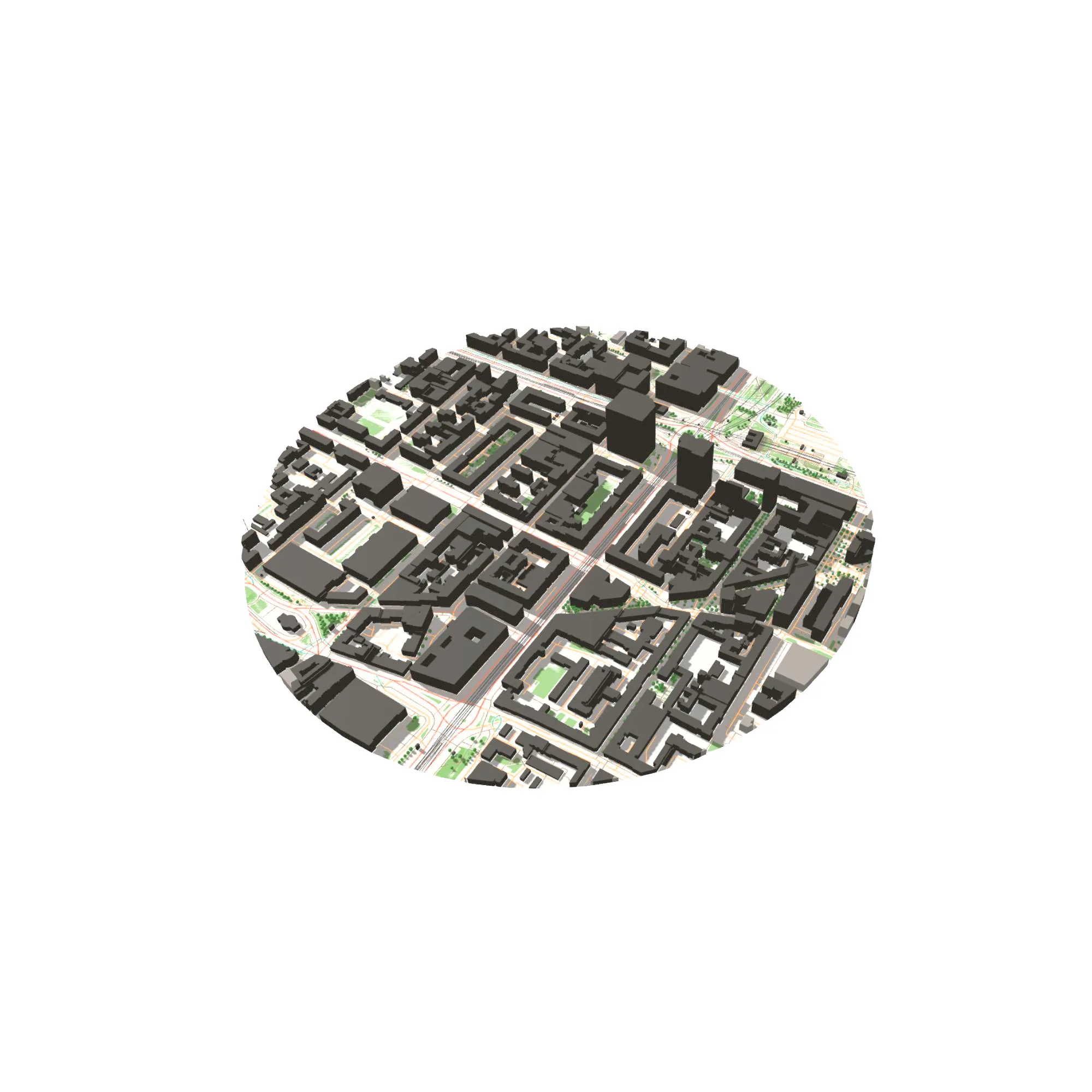
Buildings, roads, parks, and waterways are pulled in automatically from OpenStreetMap so you skip manual base-map preparation.
Turn any address into a structured site model in minutes. Automatically capture roads, building footprints, topography, and greenery, then export clean vectors for your CAD workflow.
On phones
The site and articles work well on phones. The full editing workspace and 3D review are available on tablets and desktop screens.


Buildings, roads, parks, and waterways are pulled in automatically from OpenStreetMap so you skip manual base-map preparation.

Review shadow reach, massing impact, and sky obstruction from any angle without leaving the same analysis workspace.

Export layered DXF, SVG, and GeoJSON packages for CAD, GIS, and presentation workflows without rebuilding the analysis.
Tokens are used only when you generate a new area or refresh source data — a small area costs one token and larger areas cost more. Presets, manual edits, DXF import, shadow study and normal exports stay included.
Try the workflow and generate a first real site analysis before upgrading.
Built for students, diploma projects, studio classes and competition prep.
For independent architects who need a reliable context workflow without enterprise pricing.
For small offices and urban teams needing custom limits or dedicated assistance.
Extra tokens
Monthly plan tokens reset each billing cycle and do not roll over. Extra tokens are used only after the monthly allowance is exhausted and stay valid for 12 months.
How tokens work